

Once again I was blessed with a sunny morning. I had breakfast, loaded up the bike, thanked my Warm Showers hosts for the food, lodging, and companionship, and headed out.
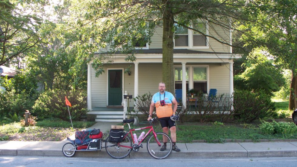
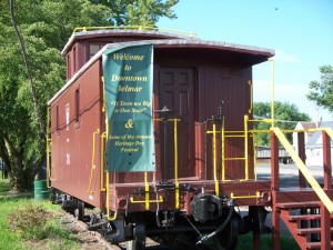
The first stop was a few blocks away, the Delmar post office. You may notice atop my rear rack a box containing excess gear I was mailing home. I arrived prior to the office’s opening, and spent a few minutes exploring the surrounding blocks. I’m glad I did, since it allowed me to see the town’s caboose:
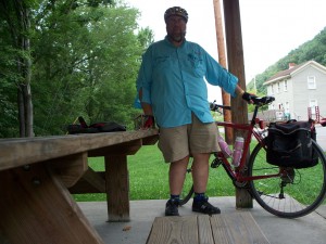
Once I had my package mailed, I headed east on Main Street, which is also Rt 54. The road straddles the Mason-Dixon line, so I guess I was in Maryland at this point. I crossed the road and state line just outside Delmar for more fluids, although to judge from the first photo above I appeared to be doing well with them. (I had been constantly hydrating this trip, and by now I was appearing very bloated. My shorts and jersey barely fit that morning.)
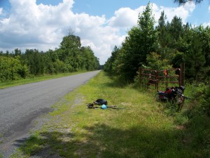
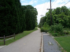
Back on Rt. 54, I rode past my planned turnoff. Once I discovered the error, I pulled over and consulted Delaware’s wonderful bike maps and found an alternate road that would take me north into the First State to Rt. 24. After I put away the map, I discovered a sponginess in my front tire. It wasn’t flat, but it felt low. I pumped it up and went on.
I turned off Rt. 54 onto my planned route, and followed it north. A check a few minutes later showed the front tire softer again, so I found a stretch of road with a nice fence to prop the bike up against and set about changing the tube. During the 25 minutes I was there I saw one car go past, so quiet was this road on a weekday morning.
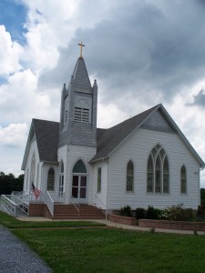
Again rolling, I reached Rt. 24 after passing through some lush farmland and spending a minute at Bethany Church. The historical marker outside indicated the church construction had been partially financed by department store pioneer John Wanamaker, one of a number of such projects the retailer was involved with. I wonder if he had anything to do with the design of the church or its courtyard, since Wanamaker took an interest in such details.
The clouds darkening overhead prompted me on. My plan was to arrive in Millsboro about 1:00 PM for lunch. And at precisely one I pulled into town. With hopes of a good meal I found a little diner and went in.
My hopes were disappointed. The service was slow, the kitchen got my order wrong, and I was subjected to the attentions of Millsboro’s version of that small town staple the Garrulous Old Man.
The Garrulous Old Man is the elderly fellow who in past centuries sat outside the town general store or post office all day talking to, or more accurately at, visitors and passersby. He’s related by method to the fools in the office who spend too much time hanging out at the water-cooler or vending machine. But the water-cooler fools and the GOM not only have method in common. They also have a knack for saying the wrong thing, as I was reminded on a Wednesday in southern Delaware. Being a cyclist in cycling garb made me a natural target:
“Hey, is that your bike outside?”
“Yes, it is.”
“Do you like the brakes on that?”
“Yes, especially when I need to stop.”
“I have a bike, but I don’t like the brakes. I like the old fashioned brakes where you pedal backwards.”
“Coaster brakes? They are nice, but with the weight I’m carrying in my trailer I need something stronger than a coaster brake.”
“You know, I don’t think doctors are right when they talk about weight being bad for you. People who weigh too much can go out and do all sorts of things. What does your doctor think about your weight?”
“Excuse me, but I don’t discuss personal medical matters or my physician’s opinions with complete strangers.”
“Oh.” The GOM paused and looked towards another part of the room. “Hey Billy, come over here. Did you hear what Obama wants to do now?”
I tuned out the GOM and tried to enjoy my meal, but I was bothered by what had happened. I should be used to such comments. As a person with both a disability and obesity I thought I’d become hardened to stupid remarks. And had it been intended maliciously I wouldn’t have brooded on it. I finished my meal and left.
As I headed out Millsboro’s main street a rain shower began. I ducked into a bookshop to keep dry.
The remaining dozen or so miles to my Warm Showers host’s home were uneventful. The roads were wet but safe, traffic was light, and the miles seemed to fly by. The chafing I’d experienced had been greatly reduced thanks to the A & D Ointment I was using. I felt strong. Not fast, experienced, or good, but strong.
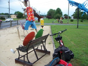
I stopped at a remarkable display of figures made from recycled metal. The artist behind the business, 2nd Time Designs, was home and gave me a tour of her studio. My bike looks at home amid the sculptures. He should, since many of therm use recycled bicycles for parts.
I arrived at my host’s home about 5:00 PM, and spent the evening with he and his wife discussing touring.
Category: Camping
Delmarva Tour, June 2009 – Part 5
I awoke at first light, sticky from the sweltering tent. Not wanting to disturb my hosts, I walked across the street to the park to use a chemical toilet and clean up. 
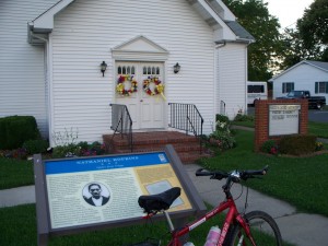
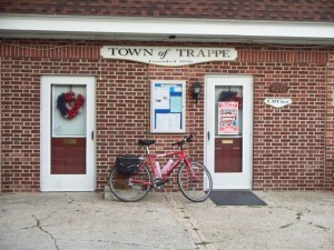
By the time my host was ready to leave for his job, I was packed and ready to roll. We exchanged goodbyes and I sped down Main Street to Rt. 50. I turned at the church on the corner, and noted the historic marker for Nathanial Hopkins, a former slave, soldier in a “colored regiment” and churchman. Hopkins helped found the church, now Scott’s United Methodist, and organized yearly celebrations of Maryland’s Emancipation Day, November 1, 1864. (Lincoln’s Emancipation Proclamation had only freed slaves in states in rebellion, as banning slavery throughout the nation by executive order was unconstitutional, and thus freedom didn’t ring in Maryland. A vote in 1864 banned slavery in the state.) The town of Trappe still observes Emancipation Day, although it’s been moved to mid-October to tie in with celebrations of the town’s founding – what the residents bill as “Trappetoberfest.”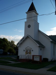
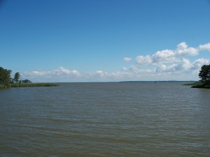
I turned south on Rt. 50 towards Cambridge. The traffic was light, and soon enough I was at the bridge crossing the Choptank River. Cambridge is near the mouth of the Choptank, and the bridge is very long. Unfortunately, the shoulder is very narrow, and I felt uncomfortably close to traffic. Clouds lowered overhead, making the day nice for photography, but not brightening my mood. Once off the bridge I pulled into the first diner I came across to have breakfast, charge my cell phone, and congratulate myself for surviving the passage. 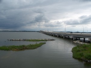
The diner food wasn’t very good, and already I was beginning to regret I didn’t do a better job of cleaning up that morning. Yet the breakfast was redeemed by an unexpected conversation. A middle-aged black man at a nearby table asked me about my trip. “I saw you in Trappe yesterday. You asked me for directions.”
I apologized for not remembering him, and after discussion of my trip, he asked a question I’d often asked myself:
“Why Trappe? Why not take a vacation to Ocean City? There’s a lot to do there.”
I must have been wound up from riding across the Choptank. That would explain the bluntness of my reply. “Ocean City isn’t real. It’s commercial and developed. It’s crowded with people who go there because other people go there and spend money there because other folks do. It’s not real. Now Trappe is real, and the Little Red Schoolhouse is real, and the Wye Oak is real. I’m going to find the real Delmarva, the real Eastern Shore, in Trappe and Wye Mills and Cambridge instead of Ocean City. And I’m finding it. Just this morning I stopped at the church on the corner of Rt. 50 and read about Nathanial Hopkins and Emancipation Day. That’s not something I could do in Ocean City.”
The man smiled. “I’m pleased to hear that. I’m a grandson of Nathanial Hopkins, about five times separated. You’ll come back for our Emancipation Day celebrations?”
I smiled back. “Trappetoberfest? I hope to. Although I think I’ll stay at the Hyatt in Cambridge instead of someone’s backyard.”
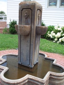
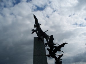
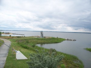
Phone charged and good mood restored, I set off to the waterfront. Cambridge, the Dorchester County seat, has a well-maintained visitor center, and there’s a lovely little park on the Choptank. Perhaps this display of descending waterfowl isn’t the greatest piece of art in the world, but I found it perfect in this setting. 
My mood was restored aside from one nagging complaint. I’d had continuing problems with chaffing in the perineum all trip, but things seemed far worse this morning. I’d taken to riding my Brooks saddle with the cover on it, thinking the pebbled finish was the cause of the problem. The lack of a shower that morning only made matters worse. I sat on the docks at Cambridge wondering how I was going to get through the tour. Finally a call to a Bike Forums member brought the suggestion of A & D Ointment, and I sought out a drugstore in town. I sheepishly walked to the counter with two tubes of a product commonly sold for diaper rash.
“So, you’re on a bike trip? Ride far?” the woman at the counter said as she rang up my purchase.
“300 some miles.”
“I’d never ride a bike that far. I’d hurt.”
“Why do you think I’m buying this stuff?” And I walked out, all pretense to dignity gone.
Because of the burning below, I altered my plans. I was to ride south to see both the Harriet Tubman Birthplace marker and Blackwater Nature Refuge, but I decided to skip those additional miles and head straight from Cambridge on Rt. 50 to Delmar, my next night stop. I did visit the Harriet Tubman Museum in Cambridge, but found the storefront location to be neglected and dispiriting. I left after I saw a cockroach climb on a rack of literature. “Moses” wasn’t treated as well as I hoped, or she deserved.
Heading east through Cambridge, the Ocean Gateway spreads to three lanes of 55 MPH traffic and little or no shoulder. After a couple of futile attempts to find alternates, I decided to ride the monster. If I were killed at least I wouldn’t have to worry about chafing, I thought. So after a stop at a gas station for more liquids and the use of the bathroom to apply ointment, I headed out. A few car horns blew at me, but I stuck to the shoulder as far as I could, ducked into a few parking lots, and soon enough the road sported a wide, clean shoulder again.
I followed Rt. 50 for the next four hours or so, stopping as needed. Unfortunately this bookstore was closed, otherwise I might have spent time browsing.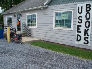
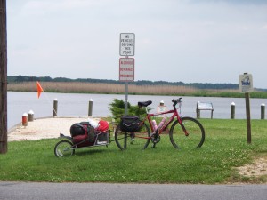
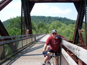
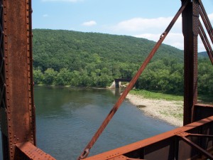
I took a brief lunch stop in Vienna, and sat along the Nanticoke and imagined how it might have looked when John Smith explored it 400 years ago. But soon enough I got on the saddle, winced, and headed over the bridge in the photo.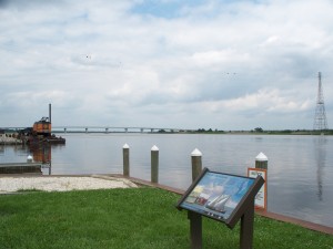
Another stop a few miles down the road led me to get a snow cone and reapply the A & D Ointment. I sent a text message that caused some banter among my friends; I advised them I was doing the ride “Clyde-style. I am stopping for a snow cone.” I received motivational texts for the rest of the trip, many on the order of “Keep going. Just think of the snow cones!”
I began to feel more comfortable in the saddle, and I headed towards Delmar with renewed energy. I left Rt. 50 for good near Mardela Springs, and headed North on Rt 54. I crossed the Mason-Dixon line, missing the marker on the Delaware border. I crossed back into Maryland at Delmar, and in a few minutes arrived at the home of my Warm Showers host. I showered, ate, and spent the evening talking about touring with my hosts before retiring.
Delmarva Tour, June 2009 – Part 3
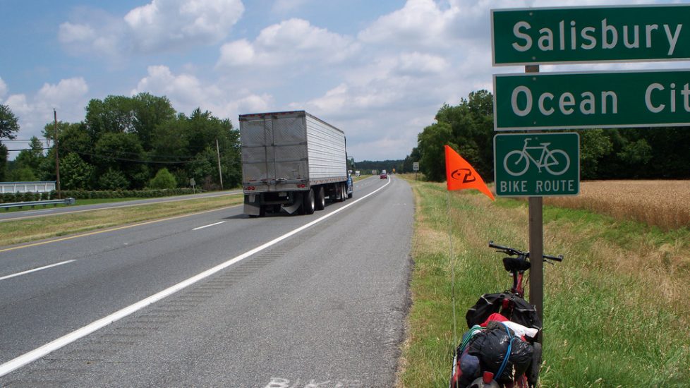
Maryland Rt. 50, the Ocean Gateway, is a 55 MPH two and three lane highway running through Queen Anne and Talbot Counties, crossing the Choptank River at Cambridge, and swinging through Dorchester as it turns east for the Atlantic coast and Ocean City. The shoulder is very bikable in most locations, clean and wide. One needs to be careful for turning cars at intersections and driveway entrances, but if you can live with the noise of the traffic speeding past you, it’s not a bad ride at all. Most of my riding today and tomorrow will be on this highway.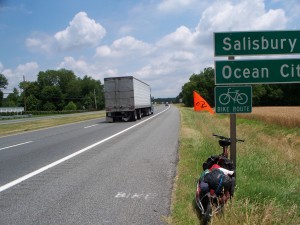
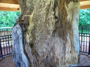
That said, it’s not a pretty ride. Fortunately in Talbot County the Maryland State Bike Map routed me onto Rt 662 for a spell, bringing me to Wye Mills, home of a functioning historic flour mill and what once was the symbol of Maryland, the 460 year old Wye Oak. One advantage touring on a weekday brought me was the chance to get a private tour of the mill, since the caretaker had no one else to talk to. 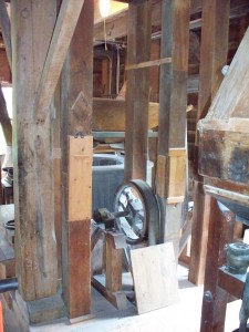
The state park was a quarter mile up the road. The white oak tree fell during a 2002 storm, but a seedling was planted in the base of the old tree, and perhaps one day it will rival its parent in size. A portion of the downed tree is on display – the first solid portion, about 30 feet up the trunk. 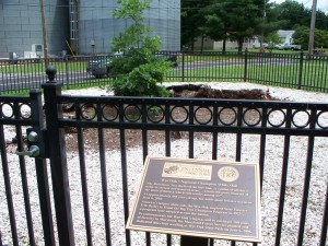
I’m afraid I didn’t spend enough time at Wye Mills. I missed the historic church and schoolhouse, and the nearby county park would have been worth a few more minutes. 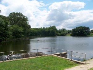
Continuing on, I kept joining and exiting the Ocean Gateway, adding miles on the highway and enjoying sightseeing when I left. I wish Talbot’s Little Red Schoolhouse had been open for a tour when I rode by.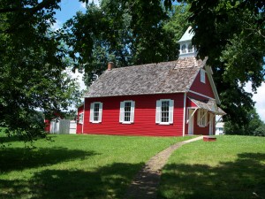
However, the sight of farms, fields rich with corn and barley, brought some consolation.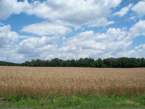
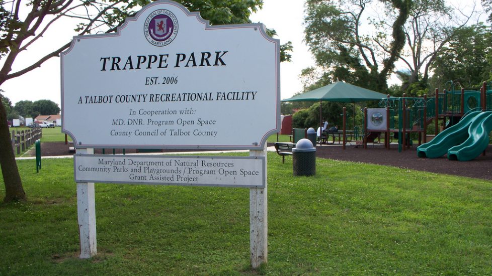
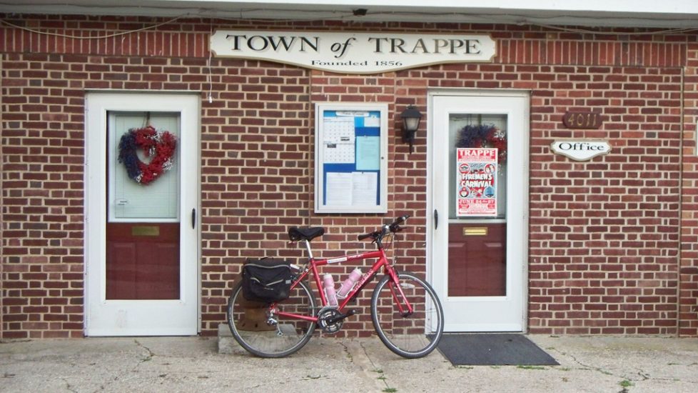
I skirted around Easton, unfortunately bypassing the historic district to make miles. I stocked up on provisions at a Target, shocking some shoppers who had apparently never seen a touring cyclist before. Or at least one my size. Then off again, rolling through farmlands along flat country roads to my night stop – Trappe, MD. 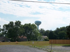
To be continued…..
Delmarva Tour, June 2009 – Part 2
Early Monday morning my host came into the spare bedroom and woke me up. 
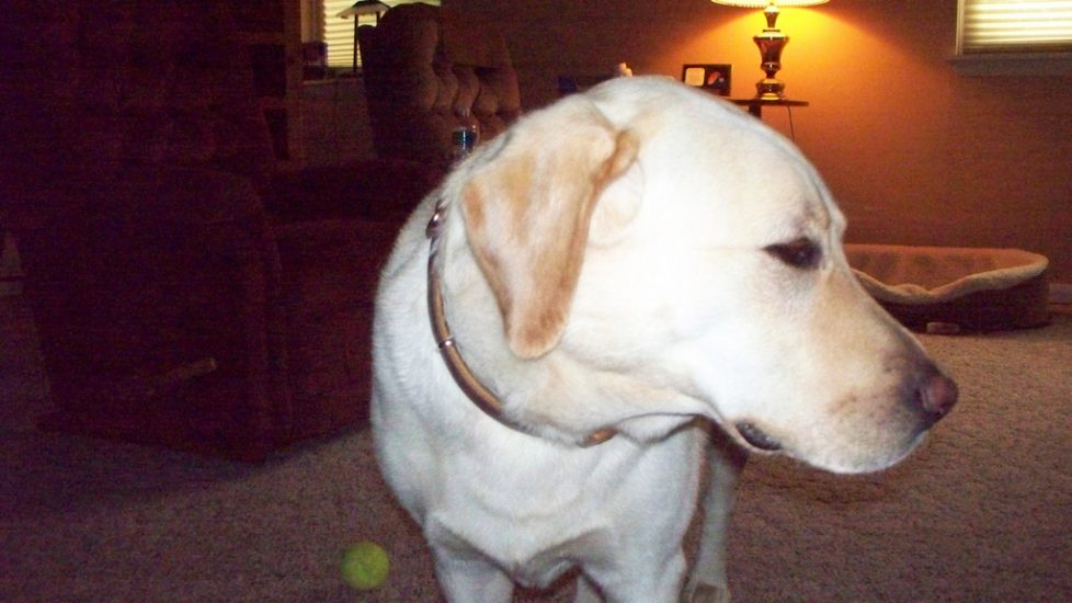
After breakfast Sadie had Daniel drive me over the Bay Bridge to Kent Island so I could resume my adventure. We arrived at a shopping center at 8:30 AM and I began to assemble the rig. In this photo, Daniel seems a little wary of the weight I’m pulling. Still, it’s less than that of a 75 pound Lab.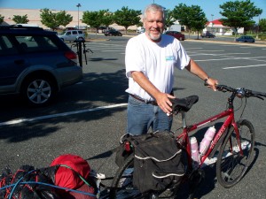
Daniel’s suggestion was I follow the access road to Rt. 18 and follow that through Kent Island, but after he left and I’d ridden it to a store for more liquids, I set my mind on finding the Cross Island Trail. The CIT travels six miles across the island and narrows, offering great views of the bay. I headed north, and while looking for it experienced another example of the serendipity I find while touring. A sign pointed to “Stevensville Historic District”, and I followed it to the right. I was rewarded with the sight of Victorian buildings, their bright colors popping out in the morning sunshine. 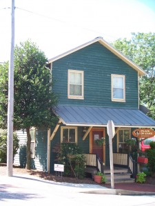
At the restored 1902 train station…..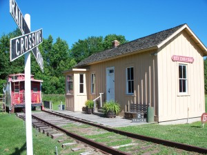
… I met up with a cyclist on his way to work. 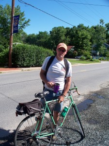
Jim is a roofing contractor, and it seemed everyone in town knows him. We spoke for a few minutes about the town and my bike, Jim taking an especial interest in my trailer. He then told me to follow him for a tour of good buildings to shoot. “I don’t want to hold you up from work” I said. “I got two days to finish the job, so I can take a few minutes” he replied as swung a leg over the top tube. And we were off. I’d never have noticed this church without Jim playing shepherd to me. 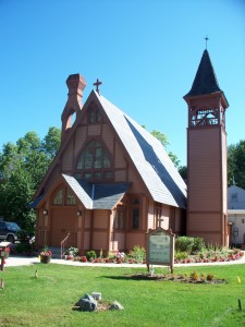
After more talk, photos, and riding, Jim led me to the trail head, passersby exchanging good morning with my leader and I. We said goodbye and good luck, friends for a quarter-hour united by a town and two wheels.
The Cross Island Trail was lovely, offering both shade and scenic views of the water and nearby flora.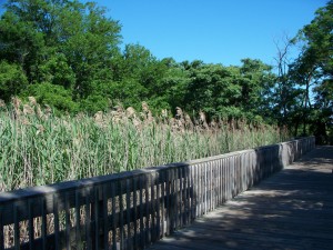
After a trip through Nature’s realm, it was back to Man’s as the trail ended at Rt 18. At the trail end is the Maryland Watermen’s Monument, a tribute to those hardy folks who lived their lives, and often gave them, on the Chesapeake. 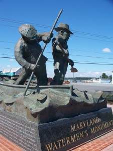
As I started on what promised to be a day of riding highways, I noticed a turtle attempting to cross Rt 18. I attempted to herd it across the narrows to the water, and was soon joined by others. We saved two turtles that morning, and I felt I’d partially repaid some of the debt I owed to Nature for the wonderful trail rides I’d had over the previous two weeks. 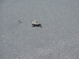
Off I went down Rt 18, searching for the bikeable portion of Rt. 50, the “Ocean Gateway.” I stopped for directions twice, rode up entrance ramps twice only to be turned back by the “No Bikes” signs, and eventually reached it after a ride through the small town of Grasonville. I saw all the trappings of small town America – the little businesses, the roadside stands, the fire hall and the post office and the homes modest and grand, all inviting me and my camera. However, I had miles to make, and they had to wait for another day. I rode up and onto the Ocean Gateway, and began to grind out miles on the shoulder as 18 wheelers sped past me.
Delmarva Tour, June 2009 – Part 1
Early in 2009, Bike Forums member Spinnaker proposed a tour for Bike Forums posters on the Montour Trail, Great Allegheny Passage, and C & O Canal Towpath. The three trails cover 380 miles from north and west of Pittsburgh, PA, and Washington, DC. I and several other posters signed up to what promised to be an exciting, taxing, but satisfying trip. Having done the trails twice in 2008, I felt I couldn’t leave it at that. “I’m a bike tourist”, I thought. “Why not ride home instead of renting a car in DC?” I pulled out maps and requested more vacation time at work. The time off was approved, the mapping went well, and before I knew it I had a planned tour.
The adventures, and sometimes misadventures, I and the other Bike Forums posters encountered during our week-long trip to the nation’s capitol are the subjects of other threads. I was stretched, bonked, and exhausted from the tour, and Bike Forums member ALHanson was kind enough to host me Friday and Saturday nights, June 19 and 20, so I could recover for my departure the morning of the 21st.
My original plans had been to ride from ALHanson’s home in Northern VA to Annapolis, but I increasingly became concerned about the lack of a good bike route between DC and Maryland’s capitol. A few exchanges on Bike Forums produced an offer of a ride, and so I was soon at Baltimore-Washington International Airport. I rode the bike trail that circles the airport, followed a connector, and soon enough was headed down the Baltimore and Annapolis Trail to the Chesapeake. The trail offered me both a short day and more time to recover from the knee trouble and chafing problems I’d suffered during the previous week.
The B and A is a rail trail, with no more than a two per cent grade down to the coast. This being a Sunday, the trail was busy with walkers and riders. The weather was warm but not sultry, and while folks perspired, the air didn’t stick to them when they stopped. And there were many places to stop as the trail wandered through the little towns along the way. I paused at the park headquarters, a former train station being restored to its Victorian small-town grandeur. 
Too soon the trail ended. But I had only a couple of miles to the city on roads with moderate Sunday traffic. I’d been advised by a rider I met at a rest stop that Annapolis crab is much better than Baltimore’s, and the view of the city from the scenic overlook was not to be missed. “Annapolis reminds me of Venice, with the domes on the churches and the water”, he said. I’m glad I stopped, for he was right about the view at least.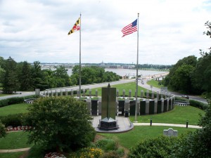
Before I knew it I crossed the Severn River and was watching boats pass by.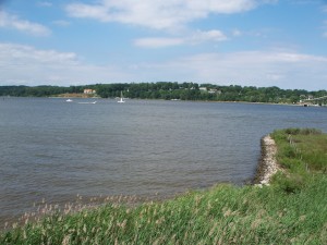
I called my hosts for the evening, folks I’d met through Warm Showers, the mutual hospitality website for touring cyclists. Little did I know my host was both a celebrity and a dog.
Sadie McCready is perhaps the most famous canine bike tourist of recent time, a distinction that almost tops the phrase “internationally known chess historian” in conversation-stopping ability. Sadie and one of her people, Daniel McCready, the week before my arrival completed an 850 mile tour from Maryland’s capitol to Maine to promote the East Coast Greenway. They raised 6000 dollars, spent more than three weeks on the road, appeared on FOX News – Sadie’s choice, no doubt, since she is a Lab – and were written up in numerous newspapers. Sadie rode in a trailer and Daniel rode a recumbent. The dog would get out on hills so Dan didn’t have to lug her 75 pounds of weight up a grade.
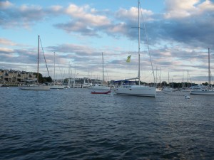
The photo shows my host and Daniel at Ego Alley on the docks in Annapolis. (Ego Alley is the nickname for the area where private boats are moored. I’ll let you guess why the name stuck.) Sadie had been honored by the Mayor at a ceremony, and throughout the evening people would pass by and point, saying “Look, there’s Sadie!” Being a Lab, she took it all in good grace.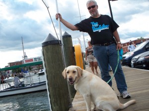
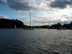
After dinner, ice cream, and a short walking tour of the historic district, Sadie, her people, and I all set off on a boat tour of the Annapolis harbor. We four were the only travelers on the boat, and the sun was beginning to set. The condition of the light was to a photographer like a doggy toy to a pup: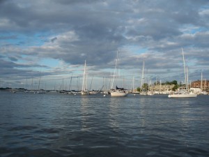
Once to my host’s home, showered, changed, and rested, I soon fell asleep, thinking of the day’s ride, and planning to make the next day as full of wonder as today had been.
Allegheny River Trail, August 2010 – Part One
My vacation for 2010 was spent on an auto tour of scenic and natural places in central and western Pennsylvania. However, I did manage to work in a short bike tour during my trip. Prior to leaving on the seventh my friend Judy and Troy “the Hobbit” from the Great Allegheny Passage Yahoo Group agreed to join me for a little trip down the Allegheny River Trail.
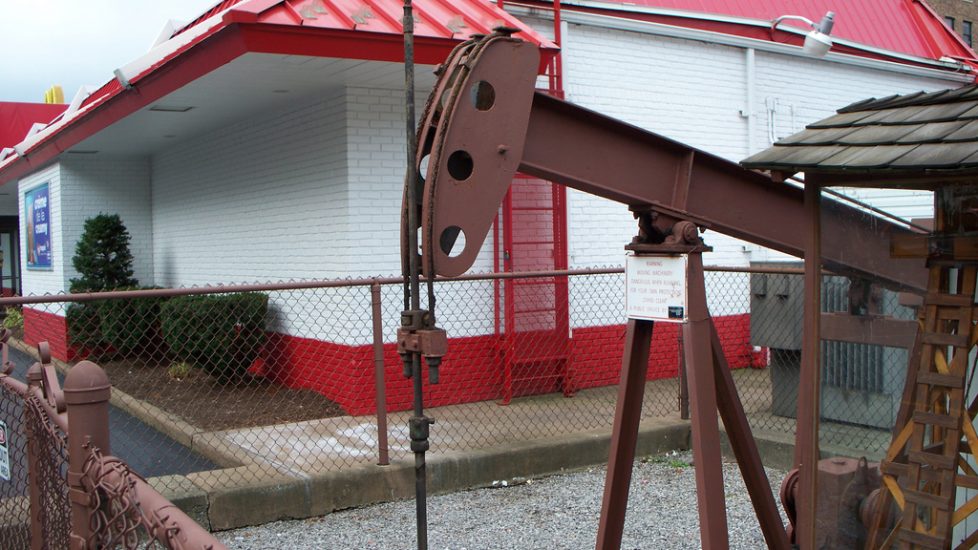
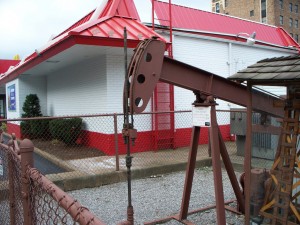
Friday, August 13, I left my hosts’ home near the New York border early for my long drive to Franklin and the Allegheny River Trail, my next stop. I visited Bradford’s downtown to see the oldest working oil well in the city, which is in the back of a McDonald’s. It’s been producing oil since the 1870s.
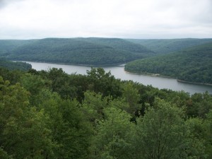
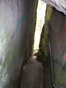
As I headed south, I stopped at several observation platforms and overlooks in Allegheny National Forest. While I found the much praised Jake’s Rocks to be overgrown and unimpressive, the Overlook Rocks were much better viewing:
… and hiking. These stairs to the base of the rock formation are a very tight fit for a Clydesdale. I was brushing both walls.
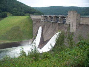
Kinzua Dam was worth a few minutes of my time:
I reached Franklin by 4:00 PM. The plans I’d discussed with Judy and Troy were to meet there, spend the night at the campsite a mile down the trail, and head out from there tomorrow morning. When I reached Franklin, they’d both decided to meet me Saturday morning instead. Having time to kill, I decided to ride up the connecting Justus Trail. I found it boring, and started the processes of putting my trailer together and loading it. This took forever, partly because I had to move anything of value into the trunk before leaving the car at the trailhead for the next two days. By the time I’d finished it was 6:30, and I wobbled off.
I’m not indulging in hyperbole to say I wobbled. Aside from ten miles in Pine Creek Gorge and three miles earlier that afternoon, I’d not ridden a bike in eight weeks. And I’d not pulled a fully loaded trailer in 14 months. It took everything I had to hold a line and keep the rubber side down. When I wobbled to a stop a mile and a tenth later, I found a canoe trip of Boy Scouts had taken over the campsite. I set up at the far end of the area and spent a quiet night.
Since I was riding such a short number of miles today, I rode in street clothes. I missed my Lycra, however:
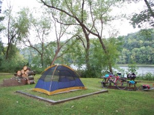
Campsite:
I retired early to the sound of the river a few feet from me. Fortunately the Boy Scouts were too tuckered out to be noisy.
Allegheny River Trail, August 2010 – Part Two
I woke up early and had a cold breakfast of trail mix while the canoe group left.
Once they were down the Allegheny, I got ready for my ride. I packed and spent ten minutes hunting for a place I could change other than the cramped portable toilets. No such luck – already there was heavy trail and river traffic and there were no blind spots at the campground. Next time change for riding BEFORE taking down the tent.
My two companions showed up as I was finishing loading my trailer. Judy came first, tipping over her trike thanks to a careless stop on a slope. Troy showed up five minutes later and took this photo while I was loading up.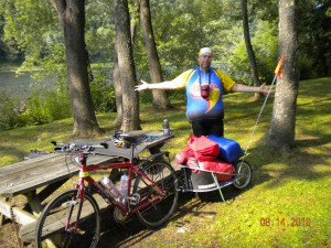
Off we went south on the Allegheny River Trail. Again I felt wobbly, but as the miles rolled on I gained control of the heavy bike. I had trouble keeping up with Troy, who is very fit and a strong rider. There’s something to be said for being a farmer; all that labor keeps you in condition. In addition to his farm,Troy is also a moderator on the Yahoo group for the Great Allegheny Passage and other trail groups, which is where I met him. He’s since this trip taken up acting, and has appeared in several films. His jokes about being a hobbit are partly due to his appetite, and partly from his “there and back again” trips on the GAP and C & O.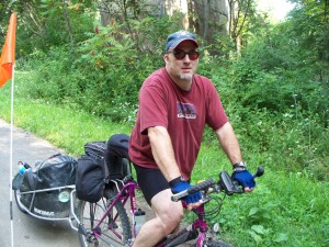
After a few miles, we reached the intersection of the Allegheny River Trail and Sandy Creek Trail. Judy, who had gotten up before 6 that morning to drive up here, volunteered to stay ‘below’ with our gear while we rode the trail. As she pulled into the shade, we unhitched and walked up the stairs to the Sandy Creek Trail. The stairs connecting the two trails are horrible, and Troy helped me get my bike up and down.
I’d already begun to sour on the Allegheny River Trail, but Sandy Creek was a delight, with seven bridges, including a massive span over the Allegheny, and a tunnel to play on. Aside from the awkward climb up to the trail, and one short uphill near the river, the trail was flat, paved, and beautiful. Sandy Creek reminds me of the Casselman River coming down into Confluence – rocky and wild. The water level was very low, however, and the stream would be more impressive had it been fuller.
After 14 miles ‘upstairs’, we went back down to the patient Judy, and continued south to our campsite north of Emlenton. The ART continued to Indian God Rock, a massive stone with Native American carvings. Unfortunately the rock has been extensively defaced since it was discovered two centuries ago. Troy scrambled down to the rock itself while Judy and I remained up on the trail at the overlook. 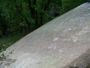
Indian God Rock, combined with the heat, induced some of my silliness:
“You know God spelled backwards is Dog?”
“Yes” said Judy.
“Indian God Rock was impressive, but I’m looking forward to seeing Indian Dog Rock. It has carvings of poodles wearing wampum beads and feathered headress.”
“Neil, do you need more water? Would you like to stop and rest in the shade?”
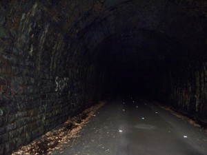
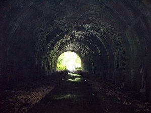
As I mentioned above, I’d begun to like the ART less and less as I rode it. True, it was paved. But there were no services – no towns, stores, restrooms – anywhere along the trail. There was a half-mile detour onto a gravel road that included two hill climbs. And there were the tunnels. The first one, Kennerdell, was three thousand feet long and lit only by reflectors. I quickly discovered my lighting wasn’t enough, and I walked the distance. Even then I became a little disoriented in the tunnel. 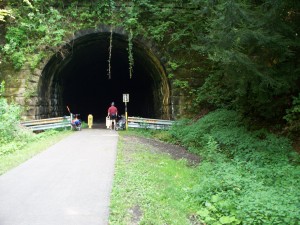
Once through the tunnel, the search for the campsite began. I had been told there was a site south of the tunnel. We kept going, and still no site. Then I spotted a table and fire ring. We pulled over and set up camp. The Boy Scout troop I’d camped with the night before floated by on the Allegheny, but decided not to stop here. 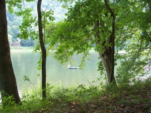
We settled in for the night shortly after seeing our first bald eagle over the river, and just as the drizzling rain set in.
Allegheny River Trail, August 2010 – Part Three
We awoke to a day of drizzle. My original goal was to ride to Emlenton, and then ride back north to Franklin, but my poor showing on the bike yesterday squashed that idea. Also, Judy had enough of the trail. So we developed a plan – Troy would ride south for breakfast, then turn round and ride north. Judy would ride back to Franklin from the campsite. I’d go on to Emlenton and wait for Judy to pick me up. So 15 minutes after Troy headed south, I left Judy as she packed up.
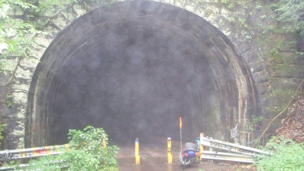
The drizzle began to break as I headed down the trail. I stopped at Rockland Tunnel, 2500 feet long, to capture the fog that poured out of the mouth. Would I meet Puff the Magic Dragon inside? Or, knowing my luck, would it be Fafner? If it was Fafner, I regretted leaving my road bike Notung at home…… Again, like the previous tunnel, I walked through it. 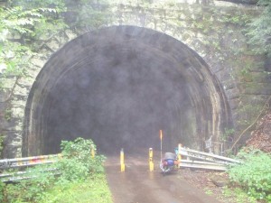
Muddy bike. Note the grocery bag under the saddle cover – I wasn’t taking any chances!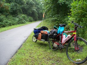
Passing through the former Quaker State facility. Emlenton is where the well-known brand of motor oil originated. You can see several old buildings and structures over the fence, but since this is a Superfund site I wasn’t crossing over it. 
I met Troy as he came back from breakfast: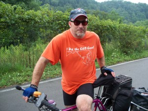
We tried to ride the unfinished portion of trail between Emlenton and Foxburg, but turned back because it was as muddy as the C & O after a rain. And unlike the C & O, this one has low overhanging trees as well. I nearly crashed as I tried to avoid one water-filled pothole. After Troy left north with snacks in his bag for second breakfast, I spent my afternoon at the little park along the Allegheny, at the gazebo on the trailhead, and at an ice cream shop with Internet access. Emlenton is a nice little community, and I didn’t draw too many stares as I pedaled my bike and trailer back and forth through town. 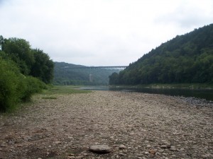
I was joined at lunch by three riders who were taking a break from their century training ride on the trail. Paul, his brother, and his 13 year old son were from Ohio and riding a 100 mile route in September. We chatted about bikes, Brooks saddles, and riding a century. I think they found it a little hard to believe that I’d ridden a century and completed the Pittsburgh to DC trip three times – Paul’s brother inspected my bike and shook his head. But I’m used to that response from cyclists, and they were nice enough people otherwise.
Judy arrived a little after three to pick me up. After retrieving my car in Franklin, we headed north to the campsite she had reserved for us in Two Mile Run Park. This is a big park run by Venagno County, and it’s fitting Judy chose this site to unwrap her latest surprise: Mega-Tent!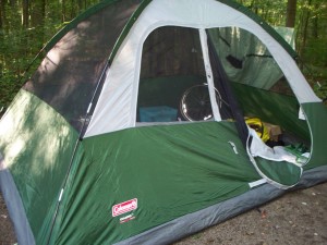
This six-man shelter was purchased with Judy’s hobby of historical reenactment in mind. Now she can change standing up in a space separate from that of 50 sweaty men getting into their French and Indian War battle uniforms. As a bonus, if she takes it on a bike tour, she can store her bike inside with her. I named the tent the “Pleasure Dome” as Coleridge’s poem came to mind as she tried to set it up.
Speaking of bike touring, Judy discovered that the actual campsite we had tried to locate was a mile or so north of where we camped. The rain had knocked over enough brush that the trail shelter was visible as she rode north. We had missed it and instead pulled into a picnic area with a table and fire ring. I became excited at learning this. “You know what this means, don’t you?” I said.
“That we stealth camped.”
“Yes, we stealth camped. According to the ‘rules’, we are now ‘real’ bike tourists!” I raised my water bottle in triumph.
Ohiopyle and Oldtown, August 2010 – Part 3
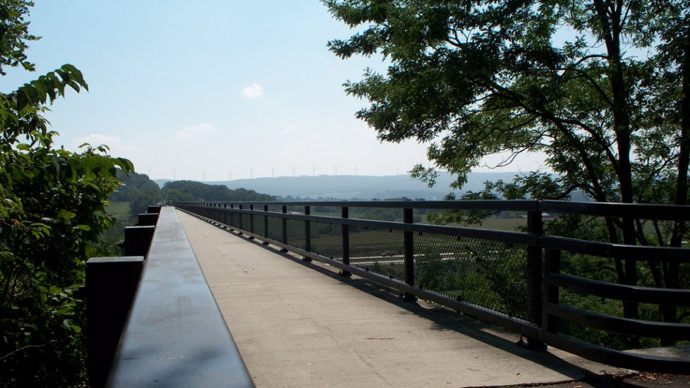
The morning was warm as I set out from Rockwood. After a full breakfast, showering and using the computer at the showerhouse/game room at Husky Haven, JAGraham left to get lunch for us, drop my camping gear off in my car in Cumberland, and to park her car at the Deal Trailhead. Meanwhile, I had to grind up from Rockwood to Garrett as the day grew warmer. This part of the Passage isn’t very steep, but my legs found it tougher than I expected. However, once I reached Garrett the climb lessened, and soon enough I was at Salisbury Viaduct. 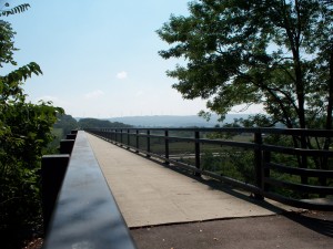
By the time I’d reached Keystone Viaduct, on the other side of Meyersdale….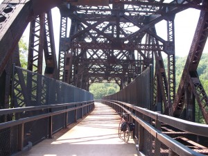
… I’d begun to feel queasy. I don’t know if it was the heat, not enough fluids, or a Clif Bar I’d had an hour before, but as I pedaled on I was very sick to my stomach. Finally as I neared Sand Patch I thought “I feel like I could throw up.” And a minute later I was at the side of the trail doing just that. I stopped for a few minutes on the shadeless trail and drank long and hard from my water bottle. Once I felt better, I continued on. JAGraham had left the Deal Trailhead and ridden the mile to the Eastern Continental Divide where she could hang out in the cool underpass. I met her there, sat down for a few minutes, and drank a Diet Pepsi. JAGraham and I chatted with other cyclists hanging out in the cool, dark underpass. I soon recovered, and we were off on the “glide” portion of the ride.
The 24 miles.1600 feet of downhill was such a blur there’s little to say. I’ve done it four times now and it’s still a thrill. At the high point of the Passage: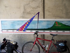
Big Savage Tunnel: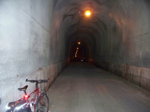
View from the south end of Big Savage Tunnel. Welcome to Maryland!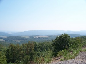
Cyclists come out of Bordon Tunnel, just above Frostburg. 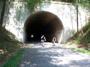
Downhill to Cumberland! The Clydesdale Express thunders down the gravel track!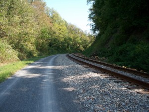
Entering the Narrows, the bottleneck north of Cumberland. It was near here in June 2008 I crashed and fractured a rib when crossing wet railroad tracks. And this was the third time I’d crossed them successfully. Practice can make perfect, it seems. 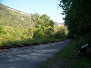
Success! Daisy the Mule watches my bike Roark at mile zero of the GAP, the Western Maryland rail station. 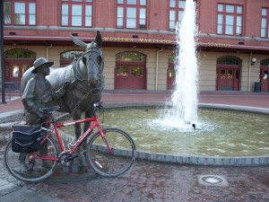
Judy and I said goodbye. She arranged to meet her husband for dinner in Cumberland, and they would drive up to retrieve her car. I packed up my bike in my car and headed out on the five hour drive home.