

This is the story of my four mile hike on a two and a half mile trail.
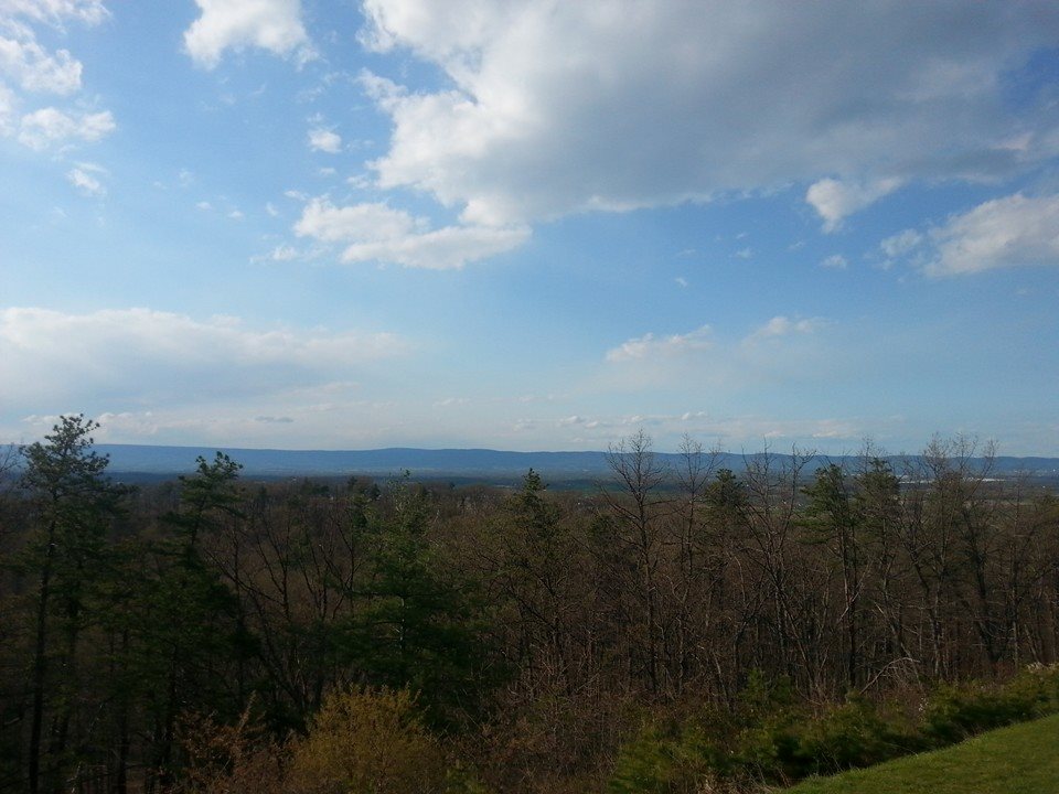
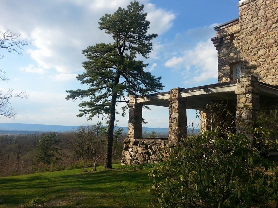 I didn’t intend to do the longer distance. When I spent my last afternoon on my recent trip to the Michaux State Forest I headed towards King’s Gap Environmental Education Center. The state park is located near Mount Holly Springs, outside of Carlisle, and is about six miles by trail from Pine Grove Furnace State Park. King’s Gap in its previous life was an estate, and the mansion house is now used by the Department of Conservation and Natural Resources for conferences and events. Sitting on a hilltop, the patio of the mansion commands a fantastic view of the Cumberland valley. On a good day you can make out Carlisle a dozen miles distant.
But while the mansion and the view is a draw, its not the only one. The park has several views, and it has trails like our forests have deer ticks. For a relatively small park there are a bewildering array of hiking possibilities, and most of them intersect at one point or another. Blazing is inconsistent, with an array of colors and shapes and signs to direct the hiker somewhere or other. Add in a hiker who needs all the help he can get and, well, you’ll see.

 I selected the 2.5 mile Scenic Vista Trail, and promptly headed in the wrong direction down the wrong trail. I soon corrected myself, and hiked beneath the patio of the mansion and and around to the south. The SVT soon merged with the Bucktail Path to Pine Grove Furnace, and just as soon diverged. The Bucktail headed south and the SVT headed back up and down around the mountain. I’d neglected to note the park trail map was a topo, and didn’t bother to note all those elevation lines the trail crossed. Still, the weather was nice and the trail surface pleasant by Rocksylvania standards. And about a mile and a half in I was rewarded by the promised scenic vista.
Once seen, I continued down the mountain. I was curious how they were going to manage to get me back to the start. After a continued downhill, followed by crossing a flooded portion of trail, I noticed this trail was, in fact, not a loop. Not expecting to do a long hike I’d not brought water. Still, I wasn’t terribly thirsty, and I thought I’d see this trail to its end.
I eventually came out at a day use area on the four mile drive up the mountain. I met a runner there, who advised me my best and shortest option to get back to my car was to follow the park road up. Although walking on pavement wasn’t appealing, I did it, and began to hike up the road. Fortunately about a mile in I noticed the Mansion Trail crossed the road, and so I followed the half mile climb up the side of the hill. I emerged from the trail a few feet from where I started. Although I’d made mistakes, having been careless in map reading and not bringing water, I was proud of myself for completing a four mile hike with nearly as much elevation change as the Pole Steeple adventure the day before. Perhaps I’m getting the hang of this, I thought. Now if I could only learn to read a map…..