

Maryland Heights was a trail I almost didn’t do. And its an example of why listening to people requires exercising discrimination.
I’d asked online about hiking to Maryland Heights, and was told it was difficult. No one was trying to discourage me. But I was discouraged at first, as I’m a novice hiker and I trust the judgment of my hiking betters. Easter Sunday I work up with a sore back and decided I was going to stick to flat, easy walks for the day.
But as the sun rose in the sky and my back muscles warmed I walked easier. I had no trouble at Bolivar Heights, and as I stood there and looked at Maryland Heights in the distance I thought “what if?” I could always attempt it and turn back if it were beyond my abilities.
Also, I’d since read about how the trail came to be formed. Maryland Heights was the location of a naval battery during the Civil War. There was only one way to get the canon up there, and that was to haul it on a road. And hauling meant horses. And horses aren’t known for hiking up rocky slopes. So there had to be a trail like the carriage roads I’d hiked in New York State. A drive by of the trailhead confirmed my suspicions. “I can do this” I said to myself.
 Scott Brown, in his recent book on hikes in Maryland, suggests parking at the small lots near the trailhead on Harpers Ferry Road, but there’s a much easier alternative – park at the national park visitor’s center and take the shuttle bus to Lower Town, and walk across the pedestrian bridge and along the C & O Canal Towpath. It adds about a half mile and a parking fee to the hike, but the walk is easy and pleasant. Soon enough you reach a wooden bridge over the canal ruins, cross it and Harpers Ferry Road, and you start up the Maryland Heights Trail.
 And up. And up. The comments about the climbing were correct. I was puffing like the pack horses 150 years ago, except I wasn’t dragging a canon up the hill. Still, I paced myself, and caught my breath when I needed to.
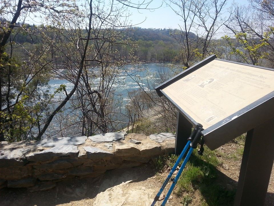
That is, I caught my breath when the scenery didn’t take it away. The elevated view of the Potomac vied with the hillside and stream views as I climbed. Meanwhile the trail was flat and smooth, not as rocky as a Pennsylvania hiking trail. Yes, it was a challenge, but not as much of one as I feared.
 The trail continues to the site of the Naval Battery, where the canon were trained on Harpers Ferry and the surrounding hillsides. I’d passed the spur trail to the ruins of the fort as it would increase the difficulty of the hike and more importantly the time – one disadvantage to parking at the national park visitor center is that the last shuttle bus from Lower Town is 5:45 PM, and I started my hike mid-afternoon. From the Naval Battery site the trail climbs further to the cliffs overlooking Harpers Ferry, and I likewise left the cliffs for another day.
 Scott Brown in his book barely mentions the Naval Battery view, but I found it worth the climb, and it made a good place to stop for a few minutes before heading back down. I caught my breath; I’d caught my courage at the start of the hike. I headed back down the road, along the canal towpath, across the bridge and to a shuttle bus, all while planning on the full six mile hike to the cliffs and fort for my next visit. The Maryland Heights trail is tough according to some hikers. But I’m tougher.